| | | | |  | |  | | | |
Curiosities of Kinder Scout
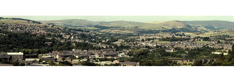
Kinder Scout is approached from Hayfield along Kinder Road, the old High Street and also the old Pack Horse route. The way runs straight up the Kinder Valley, a particularly beautiful approach in the autumn, with heather clad slopes, steep rocky gulleys, fir tree covered and as beautiful as many notable places abroad. At the end of the road is a charming lake, man made, but in keeping with its natural surroundings.
There are many beauties that Kinder Scout provides, but not a great many local people are aquainted with them, the paths where they are, are very rough, hard and stony and many people think them not worth the time and trouble, which is a great mistake.
There was traffic over Kinder before 1790 by means of Packhorse; wool, coal and iron passing between Hayfield and Edale and the Woodlands. There was a Cutlers green, and wheel on Kinder Scout, and the ruins of a Smithy and Bakers shop can still be seen. Large circular millstones were made on Kinder for all the surrounding districts and scores of them lie still near the mountains top.
One writer describing Kinder wrote “some distance in front of me beyond the undulating heather covered ground, rose a magnificent curving front, the steep side of it crowned with black edges and cliffs of grit, the outline of the south west end sweeping finely up on the right to a purple peak, the king of all the moorland around. No such colour as clothed that bronzed and reddish wall of rock, heather and bilberry is known to the Westmorland, and hardly in Scotland it seems to be the peculiar property of that lonely and inaccessible district which marks the mountainous centre of Mid England, the district of Kinder Scout and the High Peak.
The Reverend Marriott says regarding Kinder Scout :- “This is the most elevated of the Derbyshire hills and springs up from the southern point of the line that proceeded from Glossop. Its direction extends about five miles above the village of Hayfield from North West to South East in the form of a bended arm and it may be two or three miles in breadth at the place where it is possible to pass it from valley to valley. For its centre is connected with a tract of waste, interrupted by streams and hills, and dales, running from its back to the bounds of Yorkshire. This terminates in a point about 12 miles distant to the South East, past Edale, Hathersage, and Hope upon the East moor above Sheffield.”
Kinder Scout is also described by Defoe in his ‘Tour’ as “the wildest scenery in Derbyshire, this wild abyss, this womb of nature and perhaps her grave, the most desolate, wild abandoned in all England.”
Kinder Scout
Kinder – from the old Welsh meaning High Hill.
Scout – from the Danish, meaning over hanging rocks.
Kinder is a mountain set in the North West corner of Derbyshire some 2000 feet in height, a wide, windswept, rock bound table land with charming and picturesque approaches, but in its self flat swampy and uninviting.
In the olden days, people were free to come and go, for footpaths had existed on Kinder as far as memory could go back. Then about 150 years ago the land was allotted and approximately 2000 acres went to the adjoining landlords and 40 acres remaining, were left to the public, this became known as “the poor mans piece”, then later on, even this was nibbled away until it disappeared from the map.
At this point Kinder Scout became private land and people who walked there were trespassing, if permission had not first been sought from the owner.
It is a wild plateau, sparsely covered with coarse grass and vast patches of heather and bilberry to relieve its wilderness appearance, in which there is a magnificent silence. The breadth of view on Kinder on Kinder can rarely be found on any other mountain top in England and the view from here on a clear day is wonderful, and both Liverpool and Great Ormes Head can be seen.
It has the appearance of a restless inland sea, and is quite as solitary, rarely broken by eerie sounds from the ravines and gorges below, a land of bog and treacherous mud, where rivers Derwent and Kinder have their source. A gloomy mother of mist at times when clouds lower, but an earthly paradise in bright open weather, when the wind blows pure from the sea, causing the pulses to tingle and the heart to beat more strongly, the huge battlement stones, remnants of a great natural upheaval, seems very unlike a billiard table as some people suggest, but more like the billows of a stormy sea, broken in all directions by peat gulleys, is very monotonous, dreary and desolate, and one could easily go wondering around and lose all sense of direction,. It is not wise for a person to try crossing alone without previous experience.
But the view when one is on the top is worth all the trouble, rows of hills in the distance appear as though magically rolling one after another, and as one descends over the spring like turf and mountainous rocks, streams and rivulets come tippling down from the almost precipitous hillsides on their way to the lowlands beneath. The quaint warning of that sentinel of the Scout, the grouse – seems to say “Go Back! Go Back!” the bleating of the unseen sheep and the crying of the pewits are sounds which break the eerie silence, which at times is quite oppressive, shut in by the huge hillsides. At times, a strange hollow is heard filling the air for an instant then dying mysteriously away.
Edale Cross
This is an old cross situated on the Hayfield to Edale pack horse route it is situated where “Swine’s Back” (a ridge coming down from the top of Kinder towards Edale Cross) meets the old road, and is set in the angle where the wall comes down from the hill. This cross was most probably fixed by the Cistercian Abbots of Basingwerke Abbey, at the Southern boundary of land, included in the grant of the Manor and the then, wide parish of Glossop, which they received from Henry the second in 1157. It was also the boundary between Glossop and Longdendale portions of the Royal Forest of the Peak, and the “Campana” or “Open Champaign” (a stretch of level open country, that portion of the forest towards Buxton and Tideswell.
The learned Reverend Charles Cox, thought that the marking “L 1610”, alluded to a boundary survey of part of the Forest began in that year, but was never completed. The date however is 1810.
The cross at one time was smashed, and lying about, a well substantiated account tells how the cross was re-erected in 1810 by John Gee (the J.G. 1810) of Ashes Farm, Kinder, and four of his farmer friends, the small initials WD., GH., JH., & JS., refer to William Drinkwater, probably of the now deserted “Hollins Head Farm”, George and Joseph Hadfield of Upper Booth, and Joseph Shirt of the Lee Farm, Edale.
Another opinion of the origin of the cross suggests that the Knights Templar and Hospitallers were privileged from tithes, obligations and taxes etc. and that to denote the land belonging to their preceptories and commandaries, it was usual for them to erect crosses there upon, also that it was common in those days to set crosses where the corpse of a member of the nobility had rested, on the way to burial, and also at the place of burial.
Whether the cross is a forest or a parochial boundary, or a monastic cross, erected by the Monks of Basingwerke or is a Hospitallers cross has to be left to the imagination, but a chapel of the Knights Templars was founded at Basingwerke. This chapel, of which the bases of some pillars and walls still remain, must have been of great beauty, and the roof is now said to be in the church of St. Mary on the Hill, at Chester and the Cilcen Church, near Mold.
The Marriotts who at one time resided at Upper House, were tenants of the Knights Hospitallers at Ughill, near Sheffield, before coming to reside at Kinder. The chief function of the Knights Hospitallers or the Knights of Jerusalem of Rhodes and of Malta, was that of hospitality to be granted to travellers on the road, whether rich or poor. They would be assured of a warm welcome, nourishment, entertainment and a good nights rest. These places were the forerunners of Hotels, Inns and wayside Public Houses.
The Downfall and Mermaids Pool.
At a point roughly in the centre of the amphitheatre of Kinder Scout lies the Downfall or “The Old Woman Brewing”, normally the water flows from the Kinder Gates to the Downfall pouring onto the rocks far below, sometimes it is a mere trickle, but at others a raging torrent. At times, the water is raised by the Western winds, which are funnelled by the mountain to the point of the Downfall, and at these times, the water is dispersed into spray to a surprising height, which can be seen for miles around.
A striking illustration of the changes wrought by erosion of the River Kinder on the escarpment of Kinder Scout is shown by contrasting the appearance of the Downfall as described by a writer about 1870, with its appearance today. The writer describes the Downfall “At the very top of the fall before it makes its first leap, several large granite rocks have been thrown together and form an arch and ceiling above the stream, which runs sparkling over a bed of bright sand and is perfectly pure. The Grotto will hold 20 persons and has long borne the name of Mermaids Pool. It is a beautiful cavern into which the sunbeams penetrate, through the chinks of the rocks and sparkle on the water forming a delightful apartment for reflections on a hot summers day.” These rocks have long ago toppled over into the valley below.
This was the original Mermaids Pool; it was described by another writer as being approached through a cleft in the rocks.
The pool known as the Mermaids Pool today is nowhere near to the rocks, and is about 800 yards from the Downfall.
The legend regarding the mermaiden bathing on Easter eve says that any person that saw her would become immortal, a legend much more in keeping with the pool being part of the Downfall, because the mermaiden would have a very poor chance of escaping if she was bathing in the existing pool, which is exposed on all sides and rather disappointing. It is a very ordinary rush pool. There is a tradition that there is a beautiful woman, an English hamadryads, lives on the side of the Scout and she comes to bathe on the side of the pool on every Easter eve and that the man who has the good luck to behold her bathing will become immortal and never die.
Another writer said, “that the mermaids Pool had a subterranean connection with the far distant Atlantis, and at 12 p.m. on Midsummer’s Eve a mermaids arose out of he pool and sang with enchanting sweetness and allured to destruction any reckless swain who had watched to see her rise.
Jacob’s Ladder
Beyond the Edale Cross, the old packhorse route drops very steeply down to the Edale road. This steep way is known as Jacob’s Ladder, many mistakenly believe that because of the steepness of the route, it seems almost to point to heaven, that it is named after the biblical Jacob, but it is not so. It is named after one Jacob Marshall of Edale Head Farm, who had a pack horse team, and when coming up the hill from Edale to Hayfield, would send his ponies up the dog legged track, while he would climb straight up the steep side – cutting a step occasionally, and meet his packhorse team at the hill top. Thus, it became known as “Jacobs Ladder”. Now a well known landmark on Kinder Scout, which can be seen for miles on the Edale side. It steeply cuts off the angles in the bridle road, caused by the detour to Edale Head Farm. Not many years ago, the steps cut by Jacob Marshall were still there, fortunately had not been discovered by the ramblers, they were on the steepest part to the right of today’s track. The earliest date on Edale Head House Farm is 1760 and the initials are those of John and Mathew Cooper and John Marshall.
Williams Clough
Along the other side of Kinder Scout, the Glossop side, there runs a rough, wild beautiful valley, with a mountain stream tumbling down the rocks, with a path alongside, leading to the “Snake Inn”, on the Glossop to Sheffield road. It is a beautiful sylvan valley, in the autumn the heather casting a purple sheen, the mossy banks lending easily to the tread, with the mountain stream rushing quickly by.
In the days of Robert de Lexington(1228-33) it is recorded that a “William the Smith”, had made an “Assart” (or clearing) of three acres of woodland without warrant, in the liberty of the Abbot of Basingwerke and that the Abbot allowed him to retain it as a tenant. The word “Assert” signified the reduction of woodland to a condition of cultivation. This woodland was the land, which he cleared, in order to convert its timber in to charcoal for the purpose of smelting iron at his forge in “Willams Clough”, the clough takes its name from this clough.
When the reservoir was made, the remains of this iron smelting works, which was situated at the streams confluence was flooded over. It is said that small heaps of iron slag could be found on the hill, about 150 yards from and at right angles from the sheepfold in Williams Clough. It is also stated that cutlery was made in this part of Hayfield before it was ever started in Sheffield, and there is still a place in the village also on Kinder road known as Cutlers Green, also called Puddle Field.
This industry did not rest with the smelting of the iron; it meant also the manufacture of iron implements etc. The making of iron and brass metals was scattered and works were set up where the manufacturer could obtain charcoal. The name ‘The Ashes Farm’, close by Cutlers Green, Kinder indicates one place where charcoal was obtained from the wooded countryside at that time.
‘Stubbs Farm’ again near ‘The Ashes’ and Cutlers Green, refers to the stumps of trees left after the woodcutter had taken the trees for converting into charcoal.
The bareness of the hills around Hayfield and the disappearance of our woodlands was entirely due to the smelting of iron, for it is a fact that an iron trade was flourishing in Hayfield long ago.
Three loads of charcoal, which were prepared from six loads of wood, were consumed in the production of one ton of iron bars. The iron trade therefore flourished in those parts, which were thickly wooded and so the depletion of our trees continued and as he supply of wood diminished, the iron trade in these parts gradually flickered out. Considerable heaps of slag or cinders point out the spots in Derbyshire and Lancashire where the manufacturers of iron was carried on. Near the confluence of the Kinder and William Clough Brooks now submerged by Stockport reservoir, lie large amounts of iron slag, the remains of ancient iron furnaces.
The subject of one of Henry Redfern’s poems (an old Hayfield writer and historian) written about 1860 was –
“In Kinder Vale, where near proud Dimpass stands,
In a green lane, that parts the neighbouring lands
Mounds you may see, which seem but mounds of earth,
Unnoticed and considered of no worth,
But dig you down and you shall find there stow’d
Such as is left where furnaces once glowed,
And tell me, who once cast all this aside,
If artisans, in curious arts employed,
Britons or Romans in the days of yore,
The Danes, the Normans or their mixed race
For history, the record of past things,
The world’s great catalogue of states and kings
Has here a blank. No antiquarians per
Points out these hidden wonders of this glen,
And old romance with all its wondrous tales
Has no legend on these romantic vales.”
Though there are no written records to be found of this ancient industry, in the local place names there is ample evidence still preserved of this early manufactory. Take for instance Mill Hill at the head of Williams Clough; this was the location of a ‘hammer pond’. A hammer pond was used for storing the water for the turning of the water wheel upon which was mounted its hammer attached eccentrically so that each revolution beat out the ore for smelting. Hence, Mill Hill took its name from the hammer mill situated in Williams Clough. The makers of iron fixed their furnaces on the banks of swiftly running streams, rather remote from the hearths of men. The smiths were amongst the loneliest of men, living in the woods and hills and sometimes gaining a half mythical reputation.
Cutlers Green was situated on the ground on which was later built Kinder Printworks, the name of one these cutlers is to be found in the return of recusants (one who refused to obey authority, applied to Roman Catholics who refused to attend the Church of England for public religious worship) for absence from the church and divine service for 2 months past – Nicholas Wilkinson of Heafield – cutler.
Kinder Low Cavern
A guide book published many years ago says that there is a cavern at an altitude of 1866 feet, a quarter of a mile east of a shooting hut near to the top of Oaken clough on Kinder Scout – “the entrance amongst tumbled blocks is difficult to find, a series of fissures in the gritstone.” But as most local people know the cavern was sealed up and its entrance hidden over 100 years ago, and has never been reopened. Since then, many people have tried to find it, all of them in vain.
Some years ago, before the cavern was sealed and lost some people had quite an adventure there. In 1843, two men were trapped in the Kinder Low Cavern, the story was reported in the Manchester City News –
“Billy Bennett was manager of Clough Mill, Little Hayfield, was formerly what is known in the mill as –a twister- that is to say that his job was to prepare warps for weaving, by placing the threads in the loom. An operation that required little skill, but Bennett moved by degrees from this humble position to be manager of the mill. He was an eccentric and always had a fund of local gossip to dispense, his tales were usually very amusing due to his use of expressions. I was most struck by the account he gave to me of an adventure he had in his youth in a neighbouring cavern – a sobering tale with nothing of the comic about it.
It happened that a nephew of one of the owners of the mill were Bennett worked was staying at Hayfield whilst on a visit to his uncle. He was a young man with a strong interest in natural science, in all its branches, he collected, drew, examined and made notes of all sorts of plants, fossils, snails, worms, grubs, insects, fish, reptiles, birds and animals and he soon made the acquaintance of Bennett who was the person at hand best suited to give him information about the natural curiosities of the neighbourhood and guide him on the moors.
They went one morning to make a preliminary examination, Billy putting a bobbin of thread in his pocket, a few matches and a candle, for Billy knew there was a hole straight down at the entrance and they wanted to find out what depth it was.
Kinder Low is that extremity of the crescent shaped range, that rises from the road between Hayfield and Edale. If that road is followed up from the main stream in the valley, past the farm called Coldwell Clough, whilst on the right is a stream called Cold Springs. This spring rises at the foot of Kinder Low, and not very far from the summit is the entrance to the cave.
Tat the entrance they found it went straight down from the outside for approximately five feet to a sort of platform or vestibule to the floor of which they leapt, and there they met a solemn warning. On one side of the entrance there was set upon end a stone flag like a gravestone, its top almost level with the ground above, and on it were engraved these words-
Who’ers the man the man that dares this dangerous way,
That wretch no more shall see the light of day,
Shall no more see his children or his wife,
But in this dungeon sob away his life,
Lost in the black oblivion of the gloom,
Here his untimely end and here his tomb.
From the further corner of the vestibule, there opened a perpendicular hole or passage, which beyond its orifice was soon lost in darkness. Billy said that he had heard that this was the only part that went straight down, so that if they got a piece of rope long enough for it, they could manage. They then measured the depth of it by means of a thread weighed down with a stone. They also found there was a chink between two rocks on the outside across which they could fit a piece of wood and fasten their rope to the middle of it. Having got the information they wanted they settled to complete their investigation the next Monday and returned home.
In good time on that morning they sallied forth, taking with them the tackle they though necessary, namely the piece of wood mentioned, rope, a couple of candles, a box of matches, a ball of string to serve as a clue if required, a little bread and cheese, not much, as they wee not to be away long, and they did not want to burden themselves needlessly.
It was a hot day, and being thirsty and carrying no flask, they called at a farmhouse on their way to get a drink of milk, but they left their rope at the gate, so as not to attract attention and on that account they travelled over the moor, in preference to following the road. When they got to the cave, they sat and rested a while and ate their bread and cheese. Then having secured their rope, they descended easily enough, to the most inner depths below thee perpendicular entrance, the passage was on a regular incline following the stratification, in some places it was a good width, but in others it was so confined that they had to crawl through though holes which would only just allow their bodies to pass.
They set out with both candles lit but soon began to fear that they would not last long enough, so they extinguished one and went along without encountering any impassable obstacle until they came to the end of their clue. They had not seen anything particular on the way down, but now they stood peering into terrible darkness and then they saw something that attracted their attention and neither of them could make out what it was, Billy told me emphatically that it was ‘summat’ but they stood there some little time, scared and wondering what to do. But at last, their curiosity overcame their prudence and they left the end of their clue.
So, they carried on without lighting their spare candle, but of course, they were only going a few yards (or so they thought it they thought at all) but they had not got very far when an unlucky drop of water from the roof extinguished their candle, then they thought how lucky they were to have bought plenty of matches. But the first they struck would not light, the second made a kind of splutter and went out, so they tried the next and the next – none of them would light, they had all got too damp – so left in total darkness, a darkness so thick one could almost feel it, they tried to find their clue, but instead of succeeding they lost one another, and when they shouted the voice in reply seemed to come from all over the place, above, below, now in one direction and now in another, until baffled and wearied out, not knowing which way to turn, they despaired of ever getting together again.
At last after what seemed to them hours, by some explicable chance they found each other, but they gave themselves up as lost, and ceased from any further attempt to get out, so they huddled together to keep as warm as they could, for it was very cold down there and waited with the slender hope that someone might find and rescue them.
They shouted and shouted till they were hoarse, but both of them doubted though neither admitted, as to whether they could be heard outside, and their hearts sank within them when they remembered that the entrance to their prison lay on a wild rock surrounded by barren moors and was only occasionally by the chance of foot of a shepherd. They might be looked for and no doubt far and wide, and who was likely to look here for they remembered that they had not said a word to anyone about their project or what might be their fate, cold and hungry they fell asleep.
In the meantime they had been missed at their respective homes, that they did not appear at dinner time did not cause a surprise, but as the evening wore on and they remained absent some alarm was felt and enquiries made. In good time in the morning, information was received as to their probable whereabouts. It was said they had called at a farm for milk and the information was that hey had most likely gone to the cavern.
It was true that the ramblers had not told anyone of their destination, but there is not much on the moors that escapes the notice of the shepherds. A search party soon set off headed by the anxious uncle, the party armed with ropes lights and all that was necessary to unearth the wanderers if they were found at the place mentioned.
To return to the cavemen they awoke at last from their long sleep and the first sound they heard, possibly, it was that which awakened them, was the halloo of the rescuers.
It sounded to faint for the two men to be sure of this, but they both shouted out together with all their strength and were rejoiced to hear a reply, louder this time for they were wide awake now. It did not take long to get them out to the light of day.
Billy said he felt very foolish and he would never forget how ‘th’ ester’ first looking at them ‘dreeply’ tapped his snuff box twice, then taking a long pinch said “Well have you had enough.” They had been in the cave 21 hours.
The stone slab with its inscription thereon which lay within the entrance to the cavern, was carried there by two village worthies, Henry Redfern and Nathan Massey. Henry composed the verse and Nathan carved it onto the stone. Henry as one may assume was the village poet and Nathan the village handyman. He lettered gravestones, was a bookbinder, also taught a school at Little Hayfield and Chelmorten. He was also a teacher at Walk Mill Sunday School, he would tackle any kind of job – one of the last he had was the painting of a vessel prior to its sailing to South Africa, he then got a job on the ship and sailed with her to South Africa, but soon after landing there he was taken ill of fever and died.
In 1853, William Bennett and his wife left Highgate and went to reside at Little Hayfield and became members of the Primitive Methodist Church. Mrs. Bennett on being requested took a place in the circuit plan and was in great demand in a wide area.
Another writer says regarding the cavern “Its entrance being a small hollow in the broad gently sloping expanse of the heather clad peat on Kinder Low end.” He wrote of the deep cavernous recesses “a cave with sides and walls covered with thick black mud, which adheres to the clothing like paint.” And “ A spacious portion of the cavern running in a Northerly direction under a steeply sloping roof. The cavern appeared to be tricky, but not particularly extensive.”
The most persistent hunter for Kinder Low Cavern was the late Mac. Forrester genial keeper of Tunstead Guesthouse, only a mile away. He found the cavern marked on three ordnance survey maps – 300 yards from a tumulus. He took meticulous bearings and measured and paced the peaty moorland and dug for the cavern without success.
When Mac. Died he left a dossier on his searches which he passed to one of his fellow members of the Manchester Rucksack Club and these records quote an interview revealing that around 1910, two gamekeepers carried up timber to seal the caverns entrance covered this with rocks and finally camouflaged their handy work with turf. This was on the owner’s orders, presumably for greater privacy of the grouse moors of those days. One of the keepers was called Marriott and years afterwards on being questioned; he would not or could not locate the entrance.
*Tumulus - a mound of earth over a prehistoric grave also called a Barrow or a Low, as in Kinder Low end.
*Henry Redfern (the poet) died 15/11/1885, aged 75 years.
 |
| | ![]() |  | |  | | | | | |
|
|